Wayfinding Plan
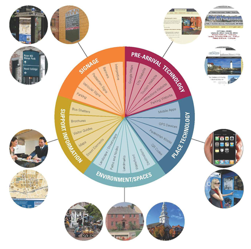 Wayfinding is a broad term used to describe the different ways that people orient themselves in a physical setting and navigate from place to place. When used in the context of a particular community, wayfinding systems may include a variety of tools (both physical and virtual) that provide a predictable and consistent way for people to find their way around. Primary objectives of community wayfinding systems include:
- Establishing a shared sense of place within the community.
- Orienting vehicular, pedestrian, and bicycle traffic with a system that is both logical and intuitive.
- Increasing accessibility to key destinations and frequently used areas within the community.
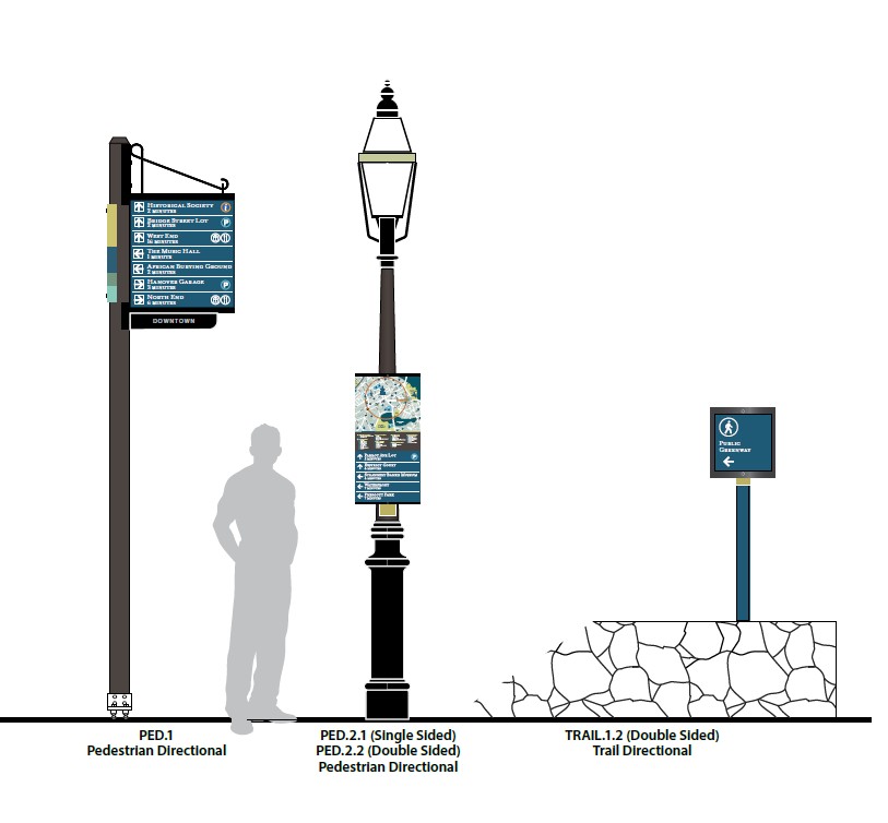
The first phase of the project was to develop a dependable and standardized wayfinding plan that identifies appropriate wayfinding types, messaging, locations, and uniform design. The City worked with MERJE, a consulting firm with extensive community wayfinding experience to develop the plan. The City is now undertaking a phased implementation of the wayfinding program. First priorities for implementation included fabrication and installation of consistent and visible parking signs and directionals, interior and exterior enhancements to the parking garage. The second phase included vehicular signage directing drivers to key visitor destinations within the downtown core and the third phase focused on vehicular signage to destinations outside of the downtown core. The final phase of implementing the wayfinding plan includes signage that facilitates pedestrian movement within the downtown core.
- Wayfinding Analysis Report (April 2014)
- Design Menu and Specifications (March 2014)
- Second Phase of City Wayfinding Program Underway (August 2015)
- Second Phase of City Wayfinding Program Continues (December 2015)
- City's Wayfinding Program to Continue this Spring (January 2016)
- Phase 3 of City’s Wayfinding Program Resumes (March 2020)
- City Begins Next Phase of Wayfinding to Support Walkability and Local Access (August 2025)